
Google Earth

500M+
Installs
Google LLC
Developer
-
Travel & Local
Category
-
Everyone
Content Rating
-
http://www.google.com/policies/privacy
Privacy Policy
Screenshots
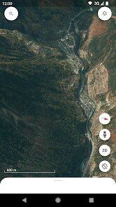
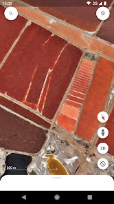
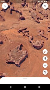
editor reviews
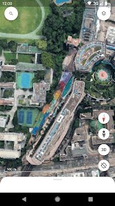
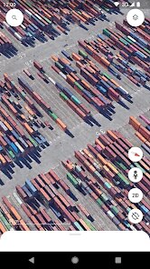
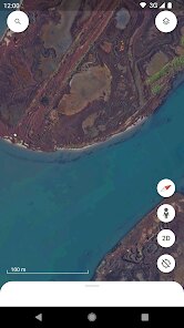
Google Earth is a geographic information program that renders a 3D representation of Earth based on satellite imagery. It is, at its core, a virtual globe, allowing you to zoom from a view of the entire planet down to the level of an individual street corner or a person's backyard. The main purpose is to provide an accessible yet incredibly detailed map of the world, using high-resolution satellite photos, aerial photography, and 3D terrain data. While it started as a simple way to view maps, it has evolved into a powerful tool for education, planning, and exploration. Its primary user base is incredibly broad; it includes students researching geography, travelers planning trips, scientists analyzing environmental changes, urban planners examining infrastructure, and just about anyone with a curiosity to see what a place looks like from above.
Regarding how well these features work, Google Earth excels at the core task of navigation and visualization. The 3D rendering is smooth, and the ability to layer on different data sets, such as roads, borders, or 3D buildings, adds immense value. The mobile version has improved dramatically. In my personal use, it helped me plan a recent hiking trip by letting me preview the terrain and trail head in three dimensions, which was far more informative than a flat map. It also solved a problem I had when trying to settle a debate about the exact distance and view from a relative's farm to a nearby mountain range. Being able to pull up the satellite view and measure the distance was incredibly satisfying and a practical use I hadn't anticipated. The 'Voyager' feature, which offers guided tours and interactive stories, is a fantastic way to learn about different parts of the world.
I would recommend Google Earth to a wide range of users. For educators, it is an indispensable tool for bringing geography and history to life. For frequent travelers, it is a superior planning tool for visualizing destinations. For professionals in fields like real estate, civil engineering, or environmental science, the pro-level features are essential. Ultimately, this app is most useful when you need to understand spatial relationships, whether you are checking the layout of a city before a visit, assessing a property's location, or simply indulging your wanderlust by exploring a remote corner of the globe. It turns a passive map into an interactive experience, making it the gold standard for virtual exploration.
features
- ✈️ The 'Measure' tool is a standout feature that goes beyond simple map viewing. It lets you measure the distance between any two points on the globe, calculate the area of a specific region, or even trace the perimeter of a field or property. I find this particularly useful for practical planning; for example, I recently measured the walking distance between two hotels I was considering for a trip, which was far more accurate than relying on estimations. This feature is essential for anyone who needs precise spatial data without using specialized GIS software.
- 🗺️ The ability to layer in '3D Buildings' and terrain data transforms a flat map into an immersive topographical model. You can tilt the view to see the profile of a mountain range, or swoop down between skyscrapers to understand their scale. This isn't just a visual gimmick; it provides a true sense of the physical environment. I use this to identify what type of forest covers a specific hillside or to understand what a canyon's depth looks like from above, which is incredibly helpful for geographical study and outdoor enthusiasts choosing running trails with elevation gain.
- 🌍 The 'Voyager' section is a curated collection of interactive guided tours, quizzes, and layers created by experts and partners. It covers a vast array of topics, from exploring the history of ancient civilizations to tracking the migration patterns of animals. This turns the app from a reference tool into a storytelling platform. I find it to be a brilliant way to learn passively; instead of just looking at a location, the stories provide context, historical data, and cultural insights that you would not get from a standard map. It makes the global exploration both educational and entertaining.
- 🔍 The 'Timelapse' feature offers a compelling view of our changing planet. It uses decades of satellite imagery to create a video of how a specific location has changed over time. You can watch the growth of a city, the retreat of a glacier, or the deforestation of a rainforest. This is more than just a novelty; it's a powerful tool for visualizing long-term environmental change. I have used it to show students the dramatic urban sprawl in their own city, making the abstract concept of climate change and human impact on the landscape tangible and immediate.
pros
- ⏱️ Free and full-featured access. The desktop version offers professional-grade features without a subscription fee, which represents an outstanding value for a tool of this sophistication.
- ⚡ Seamless performance and high-resolution imagery. The loading times are rapid, and the quality and freshness of the satellite imagery in most regions are unmatched by other free mapping services.
- 🔌 Extensive integration with Google's ecosystem. It smoothly integrates with other Google services like Drive, which allows for easy saving and sharing of custom location data.
- 🛰️ Exceptional data depth and accuracy. The platform is backed by a massive repository of geographic data that is continuously updated, providing a level of detail that is invaluable for advanced analysis.
cons
- 💾 Occasional performance issues on mobile. The mobile app can sometimes consume a significant amount of battery and data, especially during extended 3D navigation, which can be a drawback for on-the-go use.
- 🛰️ Inconsistent imagery in remote areas. The satellite resolution can be poor in less populated or rural areas, offering a highly blurred or outdated view that limits its effectiveness for detailed reconnaissance.
- 🧭 A steep learning curve for complex features. While basic navigation is simple, mastering the more powerful tools like creating detailed placemarks, crafting layered tours, or importing KML files can be intimidating for the average user.
- 📡 A reliance on a stable internet connection. The core experience is heavily dependent on streaming data; without a good connection, the app's functionality is severely limited and frustrating.
Recommended Apps
![]()
Astra - Life Advice
Vert Media Partners4.4
![]()
Question.AI - Chatbot&Math AI
D3 DIMENSION TECHNOLOGY PTE.LTD.4.5
![]()
Anima
ChristopherMoore03.2![]()
Suno - AI Music & Songs Maker
Suno, Inc4.8![]()
Name Meaning
Dexati4.1![]()
Reface: Face Swap & AI Videos
NEOCORTEXT, INC.4![]()
Astroscope: Astrology Guide
Astroscope App4.5![]()
Passport Parking
Passport Labs, Inc.2.5![]()
AXS Tickets
AXS, LLC4.2![]()
Call Santa Claus & Prank Call
WELLY GLOBAL PUBLISHING3.5![]()
PawAI: AI Cartoon Pet Filter
Now Tech3.1![]()
Waymo
Waymo LLC4.9![]()
Live football TV
Findy360 Software LLC3.7![]()
Pedometer - Step Counter
Simple Design Ltd.4.8![]()
Face Live Camera: Face Filters
Lyrebird Studio4.1














You May Like
-
![]()
FORCETELLER Astrology & Saju
Team UN7QI34.5 -
![]()
Daily Horoscope & Astrology
TELEMAQUE4.2 -
![]()
Yahoo Sports: Scores & News
Yahoo4.7 -
![]()
Uber Eats: Food Delivery
Uber Technologies, Inc.4.3 -
![]()
How I will die - Predict death
Bimdu3.2 -
![]()
Quiz Reels: Filter Challenge
Now Tech3.9 -
![]()
Broken Screen 4K Funny Pranks
Braly JSC4.1 -
![]()
Prisma3D - Animation, Modeling
Prisma3D2.8 -
![]()
Wonder - LGBTQ+ Dating App
Bumpy Inc.4.3 -
![]()
PicSo – Customize Your AI Girl
Meta Insight3.7 -
![]()
Plant App - Plant Identifier
ScaleUp4.6 -
![]()
Software Update for my phone
Art & Tool Studio4.1 -
![]()
Kling AI: AI Image&Video Maker
Lohas Games Pte. Ltd.4.4 -
![]()
Google Home
Google LLC4.2 -
![]()
Fingerprint Scan Simulator
Dream-Up3.6












Disclaimer
1.Apponbest does not represent any developer, nor is it the developer of any App or game.
2.Apponbest provide custom reviews of Apps written by our own reviewers, and detailed information of these Apps, such as developer contacts, ratings and screenshots.
3. All trademarks, registered trademarks, brand names and company names or logos appearing on the site are the property of their respective owners.
4.Apponbest abides by the federal Digital Millennium Copyright Act (DMCA) by responding to notices of alleged infringement that complies with the DMCA and other applicable laws.
5.If you are the owner or copyright representative and want to delete your information, please contact us [email protected].
6.All the information on this website is strictly observed all the terms and conditions of Google Ads Advertising policies and Google Unwanted Software policy.
7.apponbest.com is an independent, information-only website which is 100% free to all the users.